Project spotlight
Municipal Drone Inspection
SkyOps — From aerial evidence to accountable action.
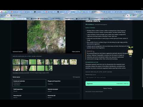
Demo Video
About This Project
SkyOps turns drone imagery into human-reviewed municipal inspection cases.
Powered by ZooWork, it inspects images, flags visible debris or surface disturbance, and produces structured findings with evidence, confidence, and uncertainty. While inspection continues, reviewers can organize photos, add notes, and approve or reject cases from a single dashboard.
Approval automatically generates a municipal report and schedules a follow-up requesting newer imagery. Rejected cases remain documented without triggering action.
Built for the hackathon using public DroneWaste images and mocked GIS metadata, SkyOps demonstrates an automated workflow with human judgment at the decision point—without model training or complex GIS infrastructure.
Repository
From aerial evidence to accountable action. A ZooWork-powered municipal drone inspection prototype with human review, reports, and scheduled follow-up.